
Map symbols and scale: teaching, slides and exercises
Map symbols, the key, colours and scale: what 1 : 100 000 means and how to measure a distance with a ruler. Slides and exercises for grades 3–4.
A map is a picture of the terrain seen from above. Reading it takes two skills. You need to know what the map symbols and colours mean. You also need to understand the scale, so that you can work out the length of a distance. The article is made for environmental studies in grades 3–4. Every step is ready to show to the class as a slide.
By the end, pupils can read from the key what the symbols mean. They measure a distance with a ruler and change it into kilometres using the scale. After that, the skills can be practised in Puro's map exercises.
Key concepts
- map
 A picture of the land seen from above. A map shows where places are.
- map symbol
 A small picture or sign on a map. It stands for something like a church, a road or a bog.
- scale
 It tells how much a map is shrunk. For example 1 cm on the map can be 1 km on the ground.
- ruler
 A straight, flat tool for measuring and drawing straight lines.
- centimetre
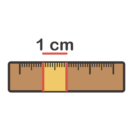 One hundredth of a metre. A finger is about a centimetre wide.
- metre
 The basic unit of length. A metre has a hundred centimetres.
- kilometre
 A thousand metres. Long distances are measured in kilometres.
- lake
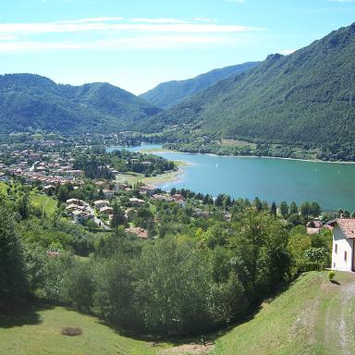 A body of water surrounded by land. Finland has more than 180,000 lakes.
Related exercises
1. What can you see on a map?
Imagine a map of the area around your school.
How can you see where a lake is?
How do you tell a road and a river apart?
How far is the swimming pool from the school?2. Map symbols and the key
On a map, houses, roads and churches show up as small pictures. They are called map symbols.
The key (also called the legend) is at the edge of the map, and it tells what each symbol and colour means. Always look at the key first.
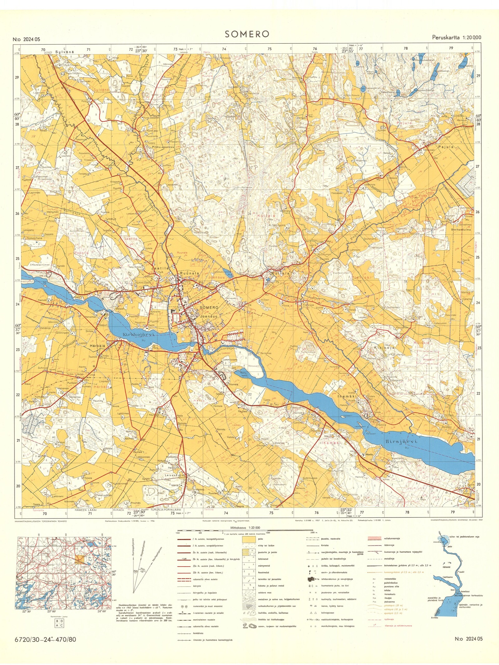
A basic map of Somero by the National Land Survey of Finland (1959). Photo: Peruskartta 202405 Somero 1959, Maanmittauslaitos, CC BY 4.0, modified: reduced in size 3. Colours on a map
The picture shows a forest and a lake from above. On a map, the lake is blue, like water on almost all maps.
The meaning of other colours varies. On an orienteering map, yellow is open land and white is easy-to-run forest. Check the colour in the key.
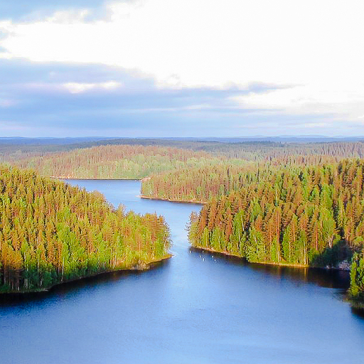
A forest and a lake from above: Repovesi National Park. Photo: Repoveden Kansallispuisto Kesayonauringossa, M. Passinen, CC BY-SA 3.0, modified: cropped to 512 × 512 px 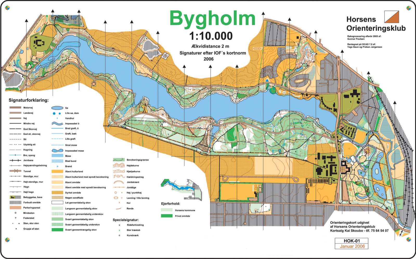
An orienteering map from Denmark: the key is on the left. Photo: Orienteringskort Bygholm 2005, Tage Baun ja Preben Jørgensen (Horsens Orienteringsklub), CC BY-SA 3.0, modified: reduced in size, converted to JPEG format 4. Scale
A map is a reduced picture of the terrain. The scale tells how much it has been reduced.
At a scale of 1 : 100 000, every distance on the map is 100 000 times shorter than in the terrain. Then 1 centimetre on the map is 1 kilometre in the terrain.
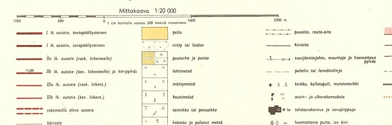
The scale of a basic map is 1 : 20 000: 1 cm on the map is 200 m in the terrain.. Photo: Peruskartta 202405 Somero 1959 (mittakaavajana ja selite), Maanmittauslaitos, CC BY 4.0, modified: cropped: the scale bar and part of the key 5. Measuring a distance
Place the zero of the ruler at the school and measure as far as the swimming pool.
On the map the distance is 4 cm. A scale of 1 : 100 000 means that 1 cm is 1 km.
Then 4 cm on the map is 4 km in the terrain.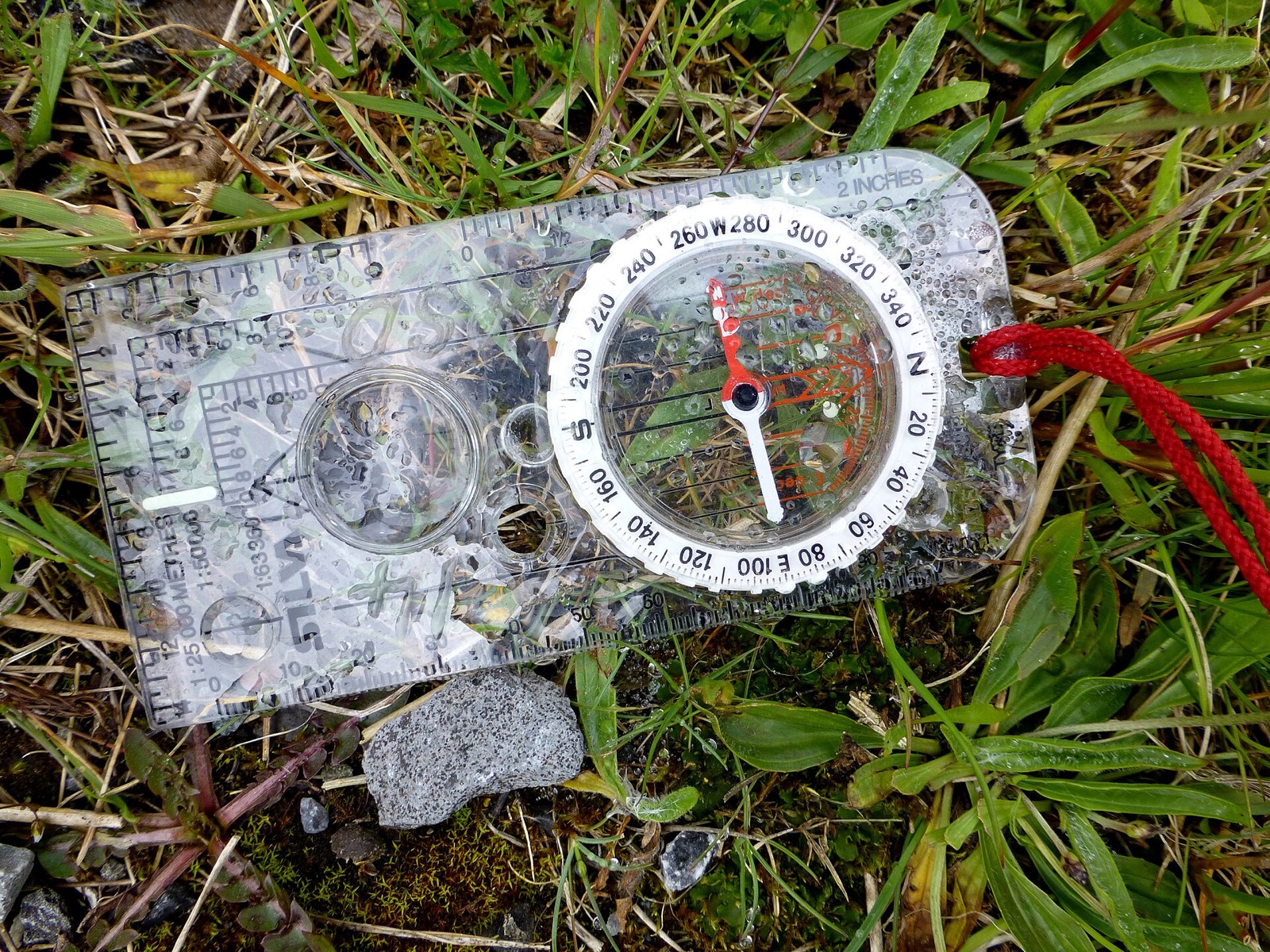
Photo: Hiker's compass, Crockunna, Kenneth Allen, CC BY-SA 2.0, modified: reduced in size 6. The same distance, a different scale
On both maps the distance is 4 cm.
At a scale of 1 : 100 000 it is 4 km.
At a scale of 1 : 50 000 it is only 2 km, because 1 cm is 500 m.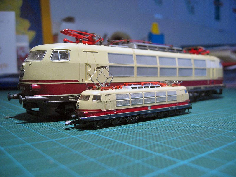
The same locomotive as miniature models: the big one at scale 1 : 87, the small one 1 : 220. A bigger number makes a smaller picture.. Photo: BR 103 im Vergleich: Spur H0 und Spur Z, Uli Kutting, CC BY-SA 3.0, modified: reduced in size 7. Practise
How long is a distance in the terrain that is 3 cm on the map, when the scale is 1 : 100 000?
How many metres is 2 cm at a scale of 1 : 50 000?
What does the colour blue mean on a map?
Where can you see what a map symbol means?


Summary
A map is a reduced picture of the terrain seen from above. Map symbols and colours are explained in the key. Water is blue on a map, but other colours are checked in the key. The scale tells how much the map has been reduced. At a scale of 1 : 100 000, one centimetre is one kilometre. At a scale of 1 : 50 000, one centimetre is 500 metres. A distance is measured with a ruler and changed into kilometres using the scale.
Frequently asked questions
Why is one centimetre one kilometre at a scale of 1 : 100 000?
On the map, all distances are 100 000 times shorter. So one centimetre on the map is 100 000 centimetres in the terrain. A metre has 100 centimetres, so that is 1 000 metres. A thousand metres is one kilometre.
Which map shows more detail, 1 : 50 000 or 1 : 100 000?
The 1 : 50 000 map. It draws the same area twice as long, so even small roads and houses fit in. The 1 : 100 000 map, on the other hand, shows a larger area on a sheet of paper of the same size.
What mistakes are common when measuring a distance on a map?
The measuring is started from the edge of the ruler and not from zero. The answer is left in centimetres even though the scale still has to be taken into account. Also, a ruler shows a straight-line distance. A winding road is longer than the straight distance.